-
Geography & Maps Activities, Beginner | Ages 6+
Rand McNally
Paperback (Rand McNally, May 13, 2016)Big, bright illustrations make finding information fun and easy for young geographers in Schoolhouse's Geography & Maps Activities, Beginners. This workbook is the perfect tool for introducing kids to geography and basic map and globe skills through hands-on activities. Geography & Maps Activities, Beginners features: A workbook to introduce map skills and world geography. Hands-on activities, colorful pictures, and interesting facts. A glossary of map terms. Dimensions: 8 1 2 x 10 7 8 Also available! Geography & Maps Activities, Intermediate | Ages 9+. ISBN-10: 0528015443 O
O
-
Folded Map: Eastern United States
Rand McNally
Map (Rand McNally, Sept. 15, 2014)Rand McNally's folded map featuring the Eastern United States is a must-have for anyone traveling in and around this part of the country, offering unbeatable accuracy and reliability at a great price. Our trusted cartography shows all Interstate, state, and county highways, along with clearly indicated points of interest, airports, county boundaries, and more. You'll see why Rand McNally folded maps have been the trusted standard for years. Regularly updated, full-color maps Clearly labeled Interstate, U.S., state, and county highways Detail maps of major cities, a mileage chart, and a Mileages & Driving Times Map Indications of parks, points of interest, airports, county boundaries, and more Easy-to-use legend Detailed index Convenient folded sizeCoverage AreaAlabama, Connecticut, Delaware, District of Columbia, Florida, Georgia, Indiana, Kentucky, Maine, Maryland, Massachusetts, Michigan, New Hampshire, New Jersey, New York, North Carolina, Ohio, Pennsylvania, Rhode Island, South Carolina, TennesseeProduct DetailsMeasures 9.5" x 4.125" and folds out to 40" x 28".
-
Know Geography™ World Atlas Grades 9-12
Rand McNally
Perfect Paperback (Rand McNally, Jan. 30, 2018)Does your child know geography? Rand McNally, the country's most trusted source for maps and atlases, just released Know GeographyTM a world atlas series created to ensure that your child knows geography!Know GeographyTM, is a grade leveled series of world atlases, designed to help students master essential map skills and gain a firm geographic understanding of their world. Engaging and richly illustrated geographic information developed from Rand McNally's award-winning Atlas of World Geography presents a more complete portrait of our physical and political world for older children. Includes glossary of foreign terminology plus comprehensive index to enrich and maximize use of maps.World Atlas Grades 9-12, features: Updated Countries section including flag, capital city, area and population 85 pages of detailed physical and political maps 35 pages of human and physical world geography maps, graphs, charts, including information on plate tectonics, climate, environments, population and economics Special continent sections exploring landforms, land cover and use, climate, and continent specific issues and current events Dimensions: 8.5 x 10.875 - Perfect Bound - 176 pages
-
Kids' Road Atlas
Rand McNally
Perfect Paperback (Rand McNally, May 1, 2015)The Kids' Road Atlas features simplified yet real road maps of all 50 states, plus Washington, D.C. Extras include state-related games plus state birds, flowers, trees and capitals. Answers for all games and puzzles are in the back of the book with an index. M
M
-
Geography & Maps Activities, Intermediate | Ages 9+
Rand McNally
Paperback (Rand McNally, May 13, 2016)Action and adventure accompany geographers on their journey around the world with Schoolhouse's Geography & Maps Activities, Intermediate. This workbook uses a fun action heroes format to help kids expand their knowledge of world geography. Geography & Maps Activities, Intermediate features: A workbook of activities that further develops map skills and world geography knowlegde. Hands-on activities, colorful pictures, and interesting facts. A glossary of map terms. Paperback, 128 pages. Dimensions: 8 1 2 x 10 7 8 Also available! Geography & Maps Activities, Beginner | Ages 6+. ISBN-10: 0528015435 R
R
-
Rand McNally Historical Atlas of the World
Rand McNally
Perfect Paperback (Rand McNally, July 31, 2015)The Historical Atlas of the World presents important periods and turning points in 5,000 years of world history in over 100 pages of thematic maps. Atlas features: 2015 copyright updated to include recent world events like the Arab Spring & changes in U.S. relations with Cuba Presents major periods of world history through more than 100 bold, colorful maps Thematic maps include literacy, languages, religions, and more Includes a section on benefits of using the atlas 112 pages, paperback, 8" x 10"
-
Know Geography™ World Atlas Grades 1-3
Rand McNally
Paperback (Rand McNally, Jan. 30, 2018)Does your child know geography? Rand McNally, the country's most trusted source for maps and atlases, just released Know Geography™ a world atlas series created to ensure that your child knows geography!Know Geography™ , is a grade leveled series of world atlases, designed to help students master essential map skills and gain a firm geographic understanding of their world. Colorful and engaging content from Rand McNally's award-winning Junior Classroom Atlas, introduces age appropriate concepts and map reading skills.World Atlas Grades 1-3, features: Handbook of Map Skills introduces map and globe reading skills Pictures, graphs, interesting facts, and thought-provoking questions that reinforce map concepts 15 colorful, current physical, political and thematic maps Glossary of geography terms Dimensions: 8.5" x 10.875" Paperback - 48 pages O
O
-
Are we there yet?
Rand McNally
Perfect Paperback (Rand McNally, May 1, 2015)Kids will stay busy for hours with this bright and colorful book filled with a wide variety of fun activities. Games include decoding puzzles, dot-to-dot mazes, car bingo, crossword puzzles and word scrambles. Answers for all games and puzzles are in the back of the book with an index.Ages 6 & up T
T
-
Kids' World Map
Rand Mcnally
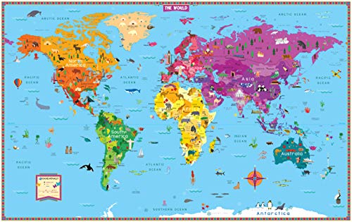
Map (Rand McNally, April 30, 2018)Rand McNally's Kids' Illustrated World Map is designed to spark curiosity in young minds. Vibrant colors and playful graphics encourage children to have fun while learning about geography, botany, zoology, history, and architecture all across the globe. Color-coded continents have delightful illustrations of native plants, animals, landmarks, cultural icons, and more. Labeled capitals, major cities, and bodies of water provide additional points of reference. As decorative as it is educational: A contemporary color palette and an elegant white border make this map perfect for children's bedrooms, playrooms, or classrooms. Kids will love it and adults will, too! Compact folded size for easy storage and shipping Product dimension: 50" x 32" Folded dimensions: 8" x 11"
-
Classroom Atlas
Rand McNally
Perfect Paperback (Rand McNally, Sept. 25, 2015)All new 2015 edition of Rand McNally's award-winning Classroom Atlas. This new edition includes 80 new pages (for a total of over 200 pages) of maps, charts & figures about the world, as well as a new special section with deeper coverage of the United States.Give your 4th-9th grade students the advantage of working with this best-selling atlas. Clearly organized by continent, Rand McNally's Classroom Atlas is packed with maps, photos, infographics, critical-thinking questions and brain teasers all helping to develop map skills and build global competency in your students.Atlas features: Over 200 pages packed with maps, photos, infographics, critical-thinking questions & brain teasers Help develop map skills & build global competency Includes essential how-to information on using an atlas 13th Edition - Copyright 2015 - Dimensions: 8.5 x 10.875 - Perfect Bound - 208 pages
-
Know Geography™ World Atlas Grades 4-9
Rand McNally
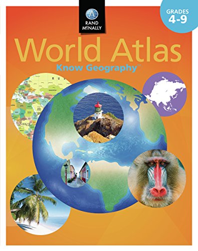
Perfect Paperback (Rand McNally, Jan. 30, 2018)Does your child know geography? Rand McNally, the country's most trusted source for maps and atlases, just released Know GeographyTM a world atlas series created to ensure that your child knows geography!Know GeographyTM, is a grade leveled series of world atlases, designed to help students master essential map skills and gain a firm geographic understanding of their world. Inspired by Rand McNally's award-winning Classroom Atlas this World Atlas for grades 4-9 is packed with maps, photos, infographics, critical-thinking questions and brain teasers designed to reinforce and further develop map skills and build global competency. World Atlas Grades 4-9, features: 200 pages clearly organized by continent Over 100 physical, political, and thematic maps Expanded section on the United States Dimensions: 8.5 x 10.875 , Perfect Bound, 208 pages
-
Easy to Read Colorado
Rand McNally
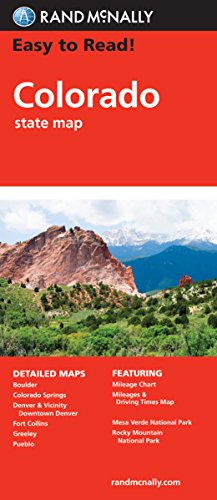
Map (Rand McNally, March 17, 2010)Rand McNally's Easy To Read State Folded Map is a must-have for anyone traveling in and around Colorado, offering unbeatable accuracy and reliability at a great price. Our trusted cartography shows all Interstate, U.S., state, and county highways, along with clearly indicated parks, points of interest, airports, county boundaries, and streets. The easy-to-use legend and detailed index make for quick and easy location of destinations. You'll see why Rand McNally folded maps have been the trusted standard for years. Regularly updated, full-color maps Larger map with a bigger type size than the Rand McNally Folded Map Clearly labeled Interstate, U.S., state, and county highways Indications of parks, points of interest, airports, county boundaries, and more Mileage and driving times map Detailed index Convenient folded sizeCoverage AreaDetailed maps of: Boulder, Colorado Springs, Denver & Vicinity, Downtown Denver, Fort Collins, Greeley, Mesa Verde National Park, Pueblo, Rocky Mountain National Park