-
No Dream Is Too High: Life Lessons From a Man Who Walked on the Moon
Buzz Aldrin, Ken Abraham
Hardcover (National Geographic, April 5, 2016)Beloved American hero and astronaut Buzz Aldrin reflects on the wisdom, guiding principles, and irreverent anecdotes he's gathered—both in outer space and on earth—through his event-filled life, in this inspiring guide-to-life for the next generation. Everywhere he goes, crowds gather to meet Buzz Aldrin. He is a world-class hero, a larger-than-life figurehead, best known of a generation of astronauts whose achievements surged in just a few years from first man in space to first men on the moon. Now he pauses to reflect and share what he has learned, from the vantage point not only of outer space but also of time: still a non-stop traveler and impassioned advocate for space exploration, Aldrin will be 86 in 2016. No Dream Is Too High whittles down Buzz Aldrin's event-filled life into a short list of principles he values, each illustrated by fascinating anecdotes and memories, such as: · Second comes right after first. NASA protocol should have meant he was first on the moon, but rules changed just before the mission. How he learned to be proud of being the second man on the moon. · Look for opportunities, not obstacles. Buzz was rejected the first time he applied to be an astronaut. Failure is an opportunity to learn to do better. · Always maintain your spirit of adventure. For his 80th birthday, Buzz went diving in the Galapagos and hitched a ride on a whale shark. He stays fit, energetic, and fascinated with life. No Dream Is Too High is a beautiful memento, a thought-provoking set of ideas, and a new opportunity for Buzz Aldrin to connect with the masses of people who recognize his unique place in human history.
-
Isle Royale National Park
National Geographic Maps - Trails Illustrated
Map (National Geographic Maps, Jan. 1, 2006)• Waterproof • Tear-Resistant • Topographic MapA rugged and isolated island on Lake Superior, Isle Royale offers unparalleled opportunities for hiking, backpacking, boating, paddling, and scuba diving in solitude, far from the sights and sounds of civilization. National Geographic's Trails Illustrated map of Isle Royale National Park delivers unmatched detail and valuable information to assist you in your exploration of this remote wilderness. Created in partnership with local land management agencies, this expertly researched map features key areas of interest including Passage Island, Rock Harbor, Windigo, and many shipwreck sites.Whether day hiking or backpacking to remote campsites, the map's clearly marked trails with mileage between intersections will help you choose the route that's right for you. The map base includes contour lines and elevations for summits and lakes, as well as soundings of Lake Superior. Boaters will appreciate the handy water mileage chart. Recreation features are clearly marked, including campgrounds, interpretive trails, lighthouses, lookout towers, ferry routes, docks, and seaplane anchorages. A variety of helpful information about camping, fishing, and boating in the region is included as well.Every Trails Illustrated map is printed on "Backcountry Tough" waterproof, tear-resistant paper. A full UTM grid is printed on the map to aid with GPS navigation.Other features found on this map include: Blake Point, Cumberland Point, Feldtmann Ridge, Isle Royale, Siskiwit Bay, Sugar Mountain.Map Scale = 1:50,000Sheet Size = 37.75" x 25.5"Folded Size = 4.25" x 9.25"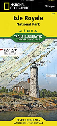
-
Glacier and Waterton Lakes National Parks
National Geographic Maps - Trails Illustrated
Map (National Geographic Maps, Jan. 1, 2009)• Waterproof • Tear-Resistant • Topographic MapNational Geographic's Trails Illustrated map of Glacier and Waterton Lakes National Parks offers unparalleled detail for outdoor enthusiasts exploring the pristine landscape of forests, mountains, lakes, and meadows within these two spectacular parks. Created in partnership with local land management agencies, this expertly researched map features key areas of interest including Many Glacier, Great Bear Wilderness, Flathead National Forest, Hungry Horse Reservoir, Lake McDonald, Flathead River, St. Mary Lake, Akamina-Kishinena Provincial Park, and the Waterton Lakes. The Glacier and Waterton Lakes map is an invaluable resource for exploring the more than 800 miles of mapped trails within the parks, including the Pacific Northwest Trail, the Continental Divide Trail, and recommended biking trails. Recreation features are clearly marked, including campgrounds, trailheads, interpretive trails, fishing and boat access, and horse rental locations. The map base includes contour lines and elevations for summits, passes and major lakes. A variety of helpful information about recreation activities available in the parks, hiking and backcountry camping, regulations, and safety tips are included as well.Every Trails Illustrated map is printed on "Backcountry Tough" waterproof, tear-resistant paper. A full UTM grid is printed on the map to aid with GPS navigation.Other features found on this map include: Apgar Mountains, Bowman Lake, Flathead National Forest, Flathead Range, Glacier, Great Bear Wilderness, Kintla Lake, Lake McDonald, Lake Sherburne, Lewis & Clark National Forest, Lewis Range, Livingston Range, Lower Saint Mary Lake, Mount Carter, Mount Cleveland, Mount Saint Nicholas, Mount Stimson, Saint Mary Lake, Upper Waterton Lake, Whitefish Lake.Map Scale = 1:100,000Sheet Size = 37.75" x 25.5"Folded Size = 4.25" x 9.25"
-
National Geographic Magazine
National Geographic
Single Issue Magazine (National Geographic, March 15, 2019)National Geographic Magazine (November, 2019) Women A Century of Change FRAMING HISTORY IN PHOTOS FROM THE ARCHIVE: Say you had an archive with tens of millions of images taken all around the globe, since the late 1800s... what stories would they tell about the lives of women? In this feature, National Geographic's director of photography, Sarah Leen, explores the images in the archive and considers how they can tell the stories of women's lives from around the world over the past 120+ years. WOMEN IN THE MILITARY: As militaries open front-line roles to women, the rise in opportunities is undeniable. They are serving on front lines in armed conflicts and acting as peacekeepers in the world's hot spots. In this feature, a veteran conflict photographer documents women warriors in training and in the field around the globe. EXCLUSIVE: Newest global rankings on the state of women around the world place Norway first and Yemen last. SAFE CITIES: India's urban women have long risked harm just by walking down the street. Now there are signs of progress, in burgeoning programs to make spaces safer and increase penalties for assailants. This feature explores the steps taken by local Indian women to lessen horrific crimes and keep them safe. RWANDA'S RENEWAL BY WOMEN: Remaking Rwanda: After the 1994 genocide, women stepped up to fill the gaps in power. Now Rwanda has some of the most female-friendly policies in the world. This feature explores all these women have accomplished and what still needs to be done. SCIENCE FAIR: The future of research is increasingly female. Programs that mentor girls interested in careers in science, technology, engineering, and math are boosting a new generation of students - and countering some of the barriers that have discouraged previous generations. This feature will explore the progress that has been made over the last few decades and what there is left to be done.
-
Under the Lemon Moon
Edith Hope Fine, Rene King Moreno
Paperback (National Geographic School Pub, June 23, 2010)Under the Lemon Moon (PB) O
O
-
National Geographic Greatest Landscapes: Stunning Photographs That Inspire and Astonish
National Geographic, George Steinmetz
Hardcover (National Geographic, Oct. 25, 2016)This iconic National Geographic photography collection of the world’s most majestic nature landscapes presents the exquisiteness of the great outdoors and showcases evocative and extraordinary images, often unseen. With vast deserts in twilight, snowcapped mountain ranges at the brink of dawn, a forest in the height of autumn colors, these indelible images will magnify the beauty, emotion, and depth that can be captured in the split second of a camera flash, taking readers on a spectacular visual journey and offering an elegant conduit to the world around them. Paired with illuminating insights from celebrated photographers, this beautiful book weaves a vibrant tapestry of images that readers will turn to again and again.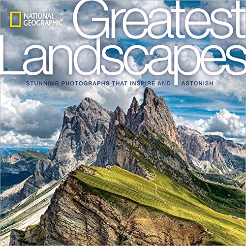
-
National Geographic: United States Executive Wall Map
National Geographic Maps - Reference
Map (National Geographic Maps, Feb. 22, 2018)National Geographic's Executive reference map of the United States features all 50 States with insets for Alaska and Hawaii in antique-executive cartographic style. Each state is colored to clearly define borders and shaded relief accentuates geographical features. All major cities, transportation routes, state boundaries, National Parks, lakes and rivers, and mountain ranges are clearly displayed and labeled.Poster sized maps make a perfect addition to any sized space. They are specially designed to maximize content in a smaller footprint than standard wall maps and fit precisely into precut poster sized frames which makes finishing and hanging them a breeze. The map is packaged in a two inch diamater clear plastic tube. The tube has a decorative label showing a thumbnail of the map with dimensions and other pertinent information. Map Scale = 1:5,410,000Sheet Size = 36" x 24"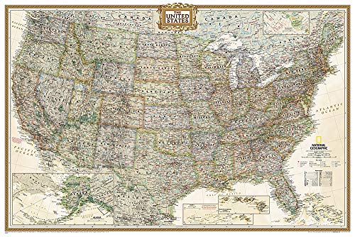
-
Library Book: Moonshot
National Geographic Learning
Hardcover (National Geographic School Pub, June 23, 2010)Look for the newly expanded edition of Moonshot, coming in to orbit on April 9th, 2019! Brian Floca explores Apollo 11’s famed moon landing with this beautifully illustrated picture book!Simply told, grandly shown, here is the flight of Apollo 11. Here for a new generation of readers and explorers are the steady astronauts, clicking themselves into gloves and helmets, strapping themselves into sideways seats. Here are their great machines in all their detail and monumentality, the ROAR of rockets, and the silence of the Moon. Here is a story of adventure and discovery—a story of leaving and returning during the summer of 1969, and a story of home, seen whole, from far away. O
O
-
National Geographic Almanac 2019: Hot New Science - Incredible Photographs - Maps, Facts, Infographics & More
National Geographic
Paperback (National Geographic, Oct. 23, 2018)A one-of-a-kind annual featuring surprising facts, stunning color photos, arresting infographics, and illuminating maps that present the world in a whole new way.An almanac like you've never seen before, this arresting volume features key information on science, nature, history, and geography, spiked with cutting-edge ideas and spectacular visuals. Discover features that only National Geographic can deliver, including exquisite photography, explanatory infographics, illustrated timelines, and maps created by expert cartographers. Chapters include Exploration & Adventure, This Planet & Beyond, Life on Earth, and The Science of Us; featured topics range from the polar jet stream and how chameleons change colors to the world's biggest cities and the science of addiction. It includes top travel trends, new explorations, and recent discoveries, as well as fascinating trivia. Enlightening for young and old, exquisitely designed, each page of this special almanac reveals something new about today's world.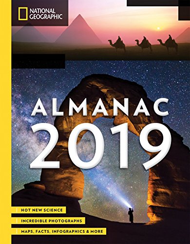
-
Brain: The Complete Mind: How It Develops, How It Works, and How to Keep It Sharp
Michael S. Sweeney, Richard Restak
Hardcover (National Geographic, Nov. 17, 2009)Did you know that listening to music tunes up your brain? Or that certain foods can help maintain mental fitness? Or that exercise can keep both body and mind in good shape? Delving into the science behind these strategies, Brain goes even deeper to reveal the brain’s inner workings.Overseen by distinguished neuropsychiatrist Dr. Richard Restak, Brainis both a practical owner’s manual and a complete guide to the brain’s development and function. Its pages explore not only the brain’s physical formits 100 billion nerve cells and near-infinite network of synapsesbut also its interactions that regulate every thought and action. Brainfeatures the latest discoveries about improving and optimizing mental acuity right alongside sidebars on breakthrough moments in neuroscience. Explained here also are the physical, emotional, and psychological aspects of the brain, addressed in accessible, engaging language.Combining the latest advances in our understanding of the mind-body connection and ongoing research into such diseases as dementia, depression, and PTSD, Brainis an indispensable guide to mens sana in corpore sanoat every stage of life.
-
Founding Fathers: The Fight for Freedom and the Birth of American Liberty
K. M. Kostyal, Jack N. Rakove
Hardcover (National Geographic, Oct. 28, 2014)Kostyal tells the story of the great American heroes who created the Declaration of Independence, fought the American Revolution, shaped the US Constitution--and changed the world. The era's dramatic events, from the riotous streets in Boston to the unlikely victory at Saratoga, are punctuated with lavishly illustrated biographies of the key founders--Alexander Hamilton, John Adams, Ben Franklin, Thomas Paine, Thomas Jefferson, George Washington, and James Madison--who shaped the very idea of America. An introduction and ten expertly-rendered National Geographic maps round out this ideal gift for history buff and student alike. Filled with beautiful illustrations, maps, and inspired accounts from the men and women who made America, Founding Fathers brings the birth of the new nation to light.
-
National Geographic: United States Explorer Wall Map - Laminated
National Geographic Maps - Reference
Map (National Geographic Maps, Oct. 13, 2015)The United States Explorer map is a classic example of the cartographic excellence National Geographic is known for. This colorful political map clearly shows state boundaries, capitals, major highways, rivers, lakes, and many major cities. Insets show detail of Alaska and Hawaii. The color palette is vibrant and stunning shaded relief provides additional texture and detail.The map is encapsulated in heavy-duty 1.6 mil laminate which makes the paper much more durable and resistant to the swelling and shrinking caused by changes in humidity. Laminated maps can be framed without the need for glass, so the fames can be much lighter and less expensive. Map Scale = 1:6,396,000Sheet Size = 32" x 20.25"