National Geographic Maps - Reference
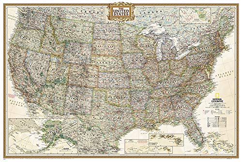
National Geographic: United States Explorer Wall Map - Laminated
The United States Explorer map is a classic example of the cartographic excellence National Geographic is known for. This colorful political map clearly shows state boundaries, capitals, major highways, rivers, lakes, and many major cities. Insets show detail of Alaska and Hawaii. The color palette is vibrant and stunning shaded relief provides additional texture and detail.
The map is encapsulated in heavy-duty 1.6 mil laminate which makes the paper much more durable and resistant to the swelling and shrinking caused by changes in humidity. Laminated maps can be framed without the need for glass, so the fames can be much lighter and less expensive.
- Map Scale = 1:6,396,000
- Sheet Size = 32" x 20.25"
- Series
- National Geographic Reference Map
- ISBN
- 1597750093 / 9781597750097
- Pages
- 1
- Weight
- 2.4 oz.
- Dimensions
- 3.4 x 3.1 in.
Enjoy reading National Geographic: United States Explorer Wall Map - Laminated? You may also like these books
-

National Geographic Maps - Reference
National Geographic: United States Classic Wall Map
Map (National Geographic Maps Oct. 20, 2019) -
National Geographic Maps - Reference
National Geographic: Appalachian Trail Wall Map in gift box Wall Map
Map (National Geographic Maps Sept. 27, 2018) -

National Geographic Maps - Reference
National Geographic: Pacific Crest Trail Wall Map in gift box Wall Map
Map (National Geographic Maps June 15, 2018) -
National Geographic Maps - Reference
National Geographic: United States Executive Wall Map
Map (National Geographic Maps Feb. 22, 2018) -
National Geographic Maps - Reference
National Geographic: World Classic Wall Map - Laminated
Map (National Geographic Maps Dec. 28, 2016) -
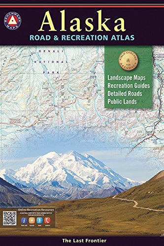
National Geographic Maps
Alaska Benchmark Road & Recreation Atlas
Paperback (Benchmark Maps March 1, 2016) -
National Geographic Maps - Reference
National Geographic: World Classic, Pacific Centered Wall Map - Laminated
Map (National Geographic Maps Feb. 27, 2019) -
National Geographic Maps - Reference
National Geographic: Destination Mars: 2 sided Wall Map
Map (National Geographic Maps Jan. 1, 2012) -

National Geographic Maps - Reference
National Geographic: France, Belgium, and The Netherlands Classic Wall Map - Laminated
Map (National Geographic Maps Nov. 12, 2014) -
National Geographic Maps - Reference
National Geographic: World Classic, Pacific Centered Wall Map
Map (National Geographic Maps Feb. 27, 2019)