-
National Geographic: United States Classic Wall Map
National Geographic Maps - Reference
Map (National Geographic Maps, Oct. 20, 2019)Our most popular United States wall map. Features all 50 States with insets for Alaska and Hawaii. All major cities, transportation routes, State boundaries, National Parks, inland waterways, and mountain ranges are clearly displayed and labeled. Available in several size, printing, and lamination configurations.Map is printed on premium quality paper stock, rolled, and packaged in a clear, hard plastic tube.Map Scale = 1:4,561,000Sheet Size = 43.5" x 30.5"
-
Iceland
National Geographic Maps - Adventure
Map (National Geographic Maps, March 4, 2016)• Waterproof • Tear-Resistant • Travel MapLet National Geographic's Iceland Adventure Map guide you as you discover the pristine nature and unique scenery on this Nordic island. The expertly researched map, with its accurate and detailed information, is designed to meet the needs of adventure travelers. In addition to a clearly marked road network, with distances and destinations of both major and main roads, the map also delivers an abundance of specialized content not found in traditional road maps. An index of cities and towns will help you arrive at your destination quickly. Recreational, ecological, cultural, and historic points of interest as well as secondary roads, remote tracks, secluded paths and ferry routes will aid in your exploration both on and off the beaten path. Among the pinpointed points of interest are hot springs, geysers, waterfalls, caves, museums, lighthouses, swimming pools, golf courses, campsites and scenic viewpoints. Also labeled are the UNESCO World Heritage Sites, Thingvellir National Park and the volcanic island of Surtsey. The shaded relief map details the entire island, contour lines are drawn, peaks and summits are labeled with elevations, forested areas are shaded, water features are shown and boundaries of National Parks and nature reserves are color-coded, making it the perfect companion to any guidebook. Every Adventure Map is printed on durable synthetic paper, making them waterproof, tear-resistant and tough — capable of withstanding the rigors of international travel.Map Scale = 1:465,000Sheet Size = 25.5" x 37.75"Folded Size = 4.25" x 9.25"
-
National Geographic The Old West
Stephen G. Hyslop
Hardcover (National Geographic, Nov. 3, 2015)This definitive history of the American West is full of legendary tales of tragedy and triumph, from Lewis and Clark’s epic 1803 expedition to the showmanship of Buffalo Bill. Lavishly illustrated with vivid photographs and intricate maps, the book is brimming with outlaws, miners, cowboys, Indians, railroad barons, and more. The characters of the Old West come alive in these dazzling pages, capturing the imagination and inspiring exploration. Travel with fur traders and trappers through the Pacific northwest; read accounts of brave pioneers heading west along the Oregon Trail; see 19th century technology progress as the golden spike connects the East and West coasts; and watch the rise and myth-building of the American cowboy unfold. Exciting, dramatic, and entertaining, this unforgettable book honors the colorful history of our nation’s past.
-
National Geographic Pocket Guide to the Night Sky of North America
Catherine Herbert Howell
Paperback (National Geographic, March 7, 2017)We all gaze at the night sky in wonder—and this guidebook, the ninth in the National Geographic Pocket Guide series, provides a go-to reference for everything filling the dark canvas above us. A basic guide to the solar system, distant galaxies, exoplanets and deep space, satellites and spacecraft, the big bang, meteor showers, and moon phases, this book also features scores of sky and constellation charts for stargazers. Each of the 147 featured topics includes a photograph or explanatory illustration or graphic. Interesting facts and tips throughout offer a quick guide to observing the night sky with the naked eye, from the Big Dipper and the North Star to auroras and eclipses.
-
World's Best Travel Experiences: 400 Extraordinary Places
National Geographic, Andrew McCarthy
Hardcover (National Geographic, Oct. 30, 2012)Popular actor and award-winning travel writer Andrew McCarthy writes the foreword to this lavish book, offering 400 awe-inspiring destinations chosen by National Geographic's family of globe-trotting contributors; dozens of fun, "Best of the World" themed lists; illuminating sidebars, several by travel and literary luminaries such as Anna Quindlen, Bill Bryson, Gore Vidal, and Pico Iyer; and hundreds of dazzling, oversized, full-color images to bring to life a wide variety of location categories--from entire countries to mountaintop villages to pristine lakes to ancient wonders. This broad, general interest travel title will appeal to active travelers looking for the next great trip as well as to the many readers who simply love dreaming of visiting far-flung, idyllic destinations, and for those who love to be "in the know" of the next travel trend. Five years after Journeys of a Lifetime hit the stores, fans are eager for the next great set of can't-miss travel hits revealed in this beautiful 2012 gift book.
-
Eyewitness to World War II: Unforgettable Stories and Photographs From History's Greatest Conflict
Stephen Hyslop, Neil Kagan
Hardcover (National Geographic, Oct. 30, 2012)The unforgettable story of World War II is told through the words of those who lived it—America’s greatest generation—both on the battlefield and the home front. Personal writings create a dramatic tapestry of wartime experience, and recollections of Roosevelt, Hitler, and Patton, as well as letters composed by soldiers at battle and diaries of women serving in the military at home, present an absorbing narrative that tells the entire history of the war from several perspectives. Hundreds of images capture fateful moments of triumph and defeat that defined the era, including rare photographs and artifacts, many never-before-seen from private collections that are placed in context with more famous photographs from the period. More than 20 authoritative National Geographic maps detail military movements and decisive battles in the European and Pacific theaters of war. These incredible, first-person stories, amazing moments of heroism, compelling imagery, and illuminating maps bring the entire history of World War II to life in vivid detail.
-
National Geographic Visual Atlas of the World
National Geographic
Hardcover (National Geographic, Sept. 19, 2017)Uniting National Geographic's incomparable photography with state-of-the-art cartographic technology, this re-imagined and completely updated visual atlas is a compelling and authoritative resource that will enthrall readers. Updated for the first time since 2008, National Geographic's visual atlas of the world will delight and inspire history lovers, current event buffs, and cartography fans alike. From spectacular space imagery to UNESCO World Heritage Sites, this stunning book showcases the diverse natural and cultural treasures of the world in glorious color. Featuring more than 200 fascinating maps, 350 new photos, and state-of-the-art cartography and satellite imagery, this is an essential reference for families, travelers, students, librarians, and scholars. Each page, created in collaboration with the world's premier scientists, geographers, and cartographers, is packed with up-to-the-minute information, making this book the most beautiful and authoritative visual atlas available today.
-
Grand Canyon, North and South Rims
National Geographic Maps - Trails Illustrated
Map (National Geographic Maps, Sept. 16, 2016)• Waterproof • Tear-Resistant • Topographic MapExplore the uniquely inspiring and wondrous landscape of the Grand Canyon with National Geographic's Trails Illustrated map of Grand Canyon National Park, North and South Rims. Expertly researched and created in partnership with local land management agencies, this map is designed to meet the needs of outdoor enthusiasts with unmatched detail of the heart of the park. Key areas of interest featured on this map include Colorado River miles 60-98, North and South Rim visitor centers, Grand Canyon Village, Tusayan, Bright Angel Trail (plus elevation profile), West Rim Trail, Kaibab Trail, Arizona Trail, and more.With miles of mapped trails in some of the most breathtaking scenery in the entire country, the Grand Canyon North and South Rims map can guide you off the beaten path and back again. Designed with a wide range of visitors in mind, this map features detailed and easy to read trails, accurate road network, campgrounds, scenic overlooks and points of interests, visitor centers and facilities, color coded bus stops with routes, plus park regulations, backcountry use areas, and contact information for local agencies. The map base includes contour lines and elevations for summits, passes and major lakes.Every Trails Illustrated map is printed on "Backcountry Tough" waterproof, tear-resistant paper. A full UTM grid is printed on the map to aid with GPS navigation.Other features found on this map include: Grand Canyon National Park, Kaibab National Forest, Little Colorado River, Marble Canyon.Map Scale = 1:50,000Sheet Size = 25.5" x 37.75"Folded Size = 4.25" x 9.25"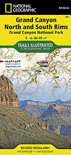
-
Library Book: The Quiltmaker's Journey
National Geographic Learning
Hardcover (National Geographic School Pub, June 23, 2010)Jeff Brumbeau's prequel to the best-selling THE QUILTMAKER'S GIFT, illustrated with Gail de Marcken's rich, sumptuously detailed paintings, will be embraced by new and old fans of the Quiltmaker.Escaping from the protective walls of wealth and privilege, a young girl discovers the harsh world outside, where some people don't have as much as others. When she realizes that she has the power to help them, the young girl finds a strength and peace she never knew before. Making the loveliest quilts in all the land, the young girl decides to give them away. M
M
-
Crazy Horse's Vision
National Geographic Learning
Paperback (National Geographic School Pub, June 23, 2010)Crazy Horse's Vision (PB) O
O
-
Zora Hurston & The Chinaberry Tree
National Geographic Learning
Paperback (National Geographic School Pub, Dec. 28, 2000)The true story of the famous writer, who as a young girl, learned about hope and strength from her mother. Zora is full of dreams. From the top of the chinaberry tree, she dreams of living in the cities beyond the horizon. Her father thinks she should wear dresses and leave dreaming and tree-climbing to boys. But her mother teaches Zora that like each new branch of the chinaberry tree, dreams are always within reach. Independent and full of spirit, Zora explores her hometown and listens to the stories of its people -- stories her mother makes her promise to remember. But it isn't until Zora is faced with her mother's death that she realizes the importance of her promise. Based on autobiographical writings of the renowned African American writer Zora Neale Hurston, this is a story that will appeal to all readers who, like Zora, believe in their dreams. M
M
-
Yellowstone and Grand Teton National Parks
National Geographic Maps - Trails Illustrated
Map (National Geographic Maps, May 19, 2010)• Waterproof • Tear-Resistant • Travel MapYellowstone National Park was the world's first national park and covers 3,500 square miles. Just to the south of Yellowstone, are the jagged peaks of Grand Teton National Park. The Map Pack Bundle includes maps of both of these iconic parks. Each park has its own character with Yellowstone's mighty falls, massive lake and dramatic geisers. Not to be overlooked, the Teton Range of Grand Teton National Park juts almost vertically from Jackson Lake. The two maps in the Map Pack cover the many thousands of square miles and show popular tourist destinations as well as the deep backcountry where only the hardcore backpacker will be seen. The maps include detailed trail networks with points of interest such as campgrounds, boat ramps, ski areas, and many more.Buy the Map Pack and save 15%!The Yellowstone and Grand Teton National Parks Map Pack includes:Map 201 :: Yellowstone National ParkMap 202 :: Grand Teton National ParkEvery Trails Illustrated map is printed on "Backcountry Tough" waterproof, tear-resistant paper. A full UTM grid is printed on the map to aid with GPS navigation.Map Scale = 1:126,720 & 1:80,000Sheet Size = 37.75" x 25"Folded Size = 4.25" x 9.25"