-
National Geographic Kids United States Atlas
National Geographic Kids
Paperback (National Geographic Children's Books, July 11, 2017)Kids will have fun learning about every U.S. state in this amazing atlas, packed with maps, stats, facts, and pictures. National Geographic's world-renowned cartographers have paired up with education experts to create maps of the 50 states, U.S. territories, and Washington, D.C., that pinpoint the physical features, capitals, and towns and cities of each state. Discover the latest data and trends along with colorful photography of each state and the people who live there. Key points reflect the latest information about land and water, people, and places. Lively essays cover each region of the country. Eight specially themed maps on nature, population, energy, climate, and more, delve deeper into key issues. State birds and state flags add to the high visual interest. This is a great reference for home and school with all the basics kids need to know to succeed in middle school, high school, and beyond.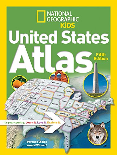 W
W
-
National Geographic Kids United States Atlas
National Geographic Kids
Library Binding (National Geographic Children's Books, July 11, 2017)Kids will have fun learning about every U.S. state in this amazing atlas, packed with maps, stats, facts, and pictures. National Geographic's world-renowned cartographers have paired up with education experts to create maps of the 50 states, U.S. territories, and Washington, D.C., that pinpoint the physical features, capitals, and towns and cities of each state. Discover the latest data and trends along with colorful photography of each state and the people who live there. Key points reflect the latest information about land and water, people, and places. Lively essays cover each region of the country. Eight specially themed maps on nature, population, energy, climate, and more, delve deeper into key issues. State birds and state flags add to the high visual interest. This is a great reference for home and school with all the basics kids need to know to succeed in middle school, high school, and beyond.
W
-
National Geographic Kids United States Atlas
National Geographic
Paperback (National Geographic Children's Books, July 10, 2012)The award-winning National Geographic Kids United States Atlas features lively maps, and graphics; updated essays and statistics; 8 thematic map spreads, on topics such as immigration, natural hazards, the water crisis, and the "greening" of America; same-size physical and political maps for each region for easy comparison; vibrant photo essays on each region and state; more than 350 full-color illustrations; 80-plus pages of National Geographic maps; 50-plus info graphics; updated state fact boxes; geo-whiz facts; state flags, birds, and flowers; comprehensive place-name index with coordinates for easy reference; and glossary of geographic terms. Just like its companion volume National Geographic Kids World Atlas, the USA atlas is INTERACTIVE. A specially designed Web site will allow kids to link directly to hundreds of National Geographic maps, photographs, and articles plus videos, music, games, and more that will expand their knowledge and perspective about this country and its states and regions. All maps are custom-designed for middle-grade students by the Society's world-famous cartographers and each is shown in the context of surrounding areas. Throughout, locator maps and color coding make it easy for kids to keep track of where they are and to quickly navigate from region to region and state to state. The combination of large, detailed, yet easy-to-read maps--both physical and political; stunning, full-color photo essays; information-packed thematic spreads; and the interactive component sets this atlas apart from every other U.S. atlas currently available for the 8-12 age market and makes it an invaluable resource. W
W
-
National Geographic Kids United States Atlas
National Geographic
Library Binding (Turtleback, July 10, 2012)FOR USE IN SCHOOLS AND LIBRARIES ONLY. Provides authoritative, up-to-date, and visually engaging maps, essays, and statistics, building on an interactive format that links kids to hundreds of online resources. W
W
-
National Geographic Kids United States Atlas
National Geographic Editors
Library Binding (Turtleback, Aug. 1, 2017)FOR USE IN SCHOOLS AND LIBRARIES ONLY. National Geographic's cartographers have paired up with education experts to create maps of the 50 states, U.S. territories, and Washington, D.C., that pinpoint the physical features, capitals, and towns and cities of each state. Discover the latest data and trends along with colorful photography of each state and the people who live there. Key points reflect the latest information about land and water, people, and places. Eight specially themed maps on nature, population, energy, climate, and more, delve deeper into key issues. W
W
-
National Geographic Kids United States Atlas
National Geographic
Paperback (National Geographic Children's Books, July 10, 2012)The award-winning National Geographic Kids United States Atlas features lively maps, and graphics; updated essays and statistics; 8 thematic map spreads, on topics such as immigration, natural hazards, the water crisis, and the "greening" of America; same-size physical and political maps for each region for easy comparison; vibrant photo essays on each region and state; more than 350 full-color illustrations; 80-plus pages of National Geographic maps; 50-plus info graphics; updated state fact boxes; geo-whiz facts; state flags, birds, and flowers; comprehensive place-name index with coordinates for easy reference; and glossary of geographic terms. Just like its companion volume National Geographic Kids World Atlas, the USA atlas is INTERACTIVE. A specially designed Web site will allow kids to link directly to hundreds of National Geographic maps, photographs, and articles plus videos, music, games, and more that will expand their knowledge and perspective about this country and its states and regions. All maps are custom-designed for middle-grade students by the Society's world-famous cartographers and each is shown in the context of surrounding areas. Throughout, locator maps and color coding make it easy for kids to keep track of where they are and to quickly navigate from region to region and state to state. The combination of large, detailed, yet easy-to-read maps--both physical and political; stunning, full-color photo essays; information-packed thematic spreads; and the interactive component sets this atlas apart from every other U.S. atlas currently available for the 8-12 age market and makes it an invaluable resource. W
W
-
National Geographic Kids United States Atlas by National Geographic
National Geographic
Paperback (National Geographic Children's Books, Jan. 1, 1704)None
-
National Geographic Kids United States Atlas
National Geographic Kids
Paperback (National Geographic Children's Books, July 11, 2017)None