-
Moon Rush: The New Space Race
Leonard David
Hardcover (National Geographic, May 7, 2019)Veteran space journalist digs into the science and technology--past, present, and future--central to our explorations of Earth's only satellite, the space destination most hotly pursued today.In these rich pages, veteran science journalist Leonard David explores the moon in all its facets, from ancient myth to future "Moon Village" plans. Illustrating his text with maps, graphics, and photographs, David offers inside information about how the United States, allies and competitors, as well as key private corporations like Moon Express and Jeff Bezos's Blue Origin, plan to reach, inhabit, and even harvest the moon in the decades to come.Spurred on by the Google Lunar XPRIZE--$20 million for the first to get to the moon and send images home--the 21st-century space race back to the moon has become more urgent, and more timely, than ever. Accounts of these new strategies are set against past efforts, including stories never before told about the Apollo missions and Cold War plans for military surveillance and missile launches from the moon. Timely and fascinating, this book sheds new light on our constant lunar companion, offering reasons to gaze up and see it in a different way than ever before.
-
Destinations of a Lifetime: 225 of the World's Most Amazing Places
National Geographic
eBook (National Geographic, Oct. 27, 2015)NatGeo takes you on a photographic tour of the world’s most spectacular destinations, inspiring tangible ideas for your next trip. Travel to hundreds of the most breathtaking locales—both natural and man-made—illustrated with vivid images taken by the organization's world-class photographers. These images, coupled with evocative text, feature a plethora of visual wonders: ancient monoliths, scenic islands, stunning artwork, electric cityscapes, white-sand seashores, rain forests, ancient cobbled streets, and both classic and innovative architecture. Loaded with hard service information for each location, Destinations of a Lifetime has it all: when to go, where to eat, where to stay, and what to do to ensure the most enriching and authentic experience.
-
Avenues C: Student Anthology
Alfredo Schifini, Deborah J Short, Josefina Villamil Tinajero, Erminda Garcia, Eugene E Garcia
Hardcover (National Geographic School Pub, March 27, 2003)Paired fiction and nonfiction literature, strong picture support, built-in instructional supports and activities, and picture dictionary in each volume N
N
-
I'm A Seed
National Geographic Learning
Paperback (National Geographic School Pub, June 23, 2010)Two seeds grow side by side, showing the life cycles of plants. The seeds become marigolds and pumpkins. G
G
-
National Geographic Guide to the World's Supernatural Places: More Than 250 Spine-Chilling Destinations Around the Globe
Sarah Bartlett
Hardcover (National Geographic, Sept. 2, 2014)Witches and demons, ghosts and vampires, aliens and voodoo spirits… from spooky to chilling to downright weird, signs of the supernatural have terrified -- and fascinated -- people for centuries. Dare to discover some of the world’s most puzzling enigmas in this remarkable book, which reveals a dazzling array of haunted castles, forbidden hideaways and otherwise eerie landmarks. Packed with rich illustrations, National Geographic’s first-ever guide to the world’s supernatural places showcases more than 250 spooky destinations around the globe. Uncover the origins of the vampire, found not only in Romania, but also in Madagascar and the Philippines. Encounter the array of ghosts said to haunt deserted battlefields, abandoned mental asylums, cemeteries and other spine-tingling sites. Consider the possibility of extraterrestrials spotted everywhere from Sedona, Arizona to Flatwoods, West Virginia. And experience the mystical origins of such extraordinary places as Ayers Rock, Australia and Chichén Itzá, Mexico. Vivid, dramatic, and chock full of inside information on when to visit, this spooky book will convince you that there might be more out there than meets the eye.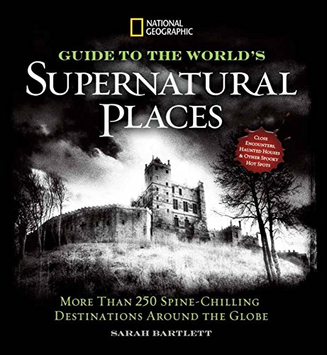
-
Appalachian Trail, Damascus to Bailey Gap
National Geographic Maps - Trails Illustrated
Map (National Geographic Maps, Oct. 23, 2015)• Waterproof • Tear-Resistant • Topographic MapThe Damascus to Bailey Gap Topographic Map Guide makes a perfect traveling companion when traversing the southwest Virginia section of the Appalachian Trail (A.T.). The A.T. in southwest Virginia travels through a culturally and historically rich area that includes fertile farmland, long, wooded ridges, and the highest mountains in the state. While the Mt. Rogers high country, just east of Damascus, is very popular with visitors, hikers can find excellent opportunities for solitude farther north on their way to the New River and Bailey Gap.Each A.T. Topographic Map Guide includes detailed topographic maps at a detail of 1 inch = 1 mile. Each page is centered on the A.T. and overlaps with the adjacent pages so there is little chance of getting lost. Along the bottom of each page is a trail profile that shows the distance between shelters, camping areas, and trail access points. The map and trail profile provide a step by step visual guide to hiking the trail, mile by rugged mile. The Topographic Map Guide is built for all levels of hiking enthusiasts, from the day tripper to the multi month 'thru-hiker'. The front pages of the printed Topographic Map Guide include resupply information, town inset maps, camping options, and much more.Every Topographic Map Guide is printed on "Backcountry Tough" waterproof, tear-resistant paper. A full UTM grid is printed on the map to aid with GPS navigation.Other features found on this map include: Abingdon Gap Shelter, Atkins, Bailey Gap Shelter, Bastian, Bland, Bluefield, Chatfield Shelter, Chestnut Knob Shelter, Damascus, Doc's Knob Shelter, Grayson Highlands State Park, Helveys Mill Shelter, Hurricane Mtn Shelter, Jefferson National Forest, Jenkins Shelter, Jenny Knob Shelter, Knot Maul Branch Shelter, Lost Mtn Shelter, Marion, Mount Rogers, Old Orchard Shelter, Partnership Shelter, Pearisburg, Pine Swamp Branch Shelter, Princeton, Rice Field Shelter, Saunders Shelter, Tazewell, Thomas Knob Shelter, Trimpi Shelter, Wapiti Shelter, Wise Shelter.Map Scale = 1:63,360Folded Size = 4.25" x 9.25"
-
National Geographic Guide to the National Parks of Canada
National Geographic
Paperback (National Geographic, Dec. 27, 2016)This completely updated guidebook shows you how to make the most out of your visit to Canada’s 47 gorgeous national parks, just in time for Canada’s 150th birthday—from Cape Breton Highlands to Banff to Pacific Rim National Park Preserve, plus the five newest additions: Nááts'ihch'oh National Park Reserve, Mealy Mountains, Rouge Urban, Qausuittuq, and Sable Island National Park Reserve of Canada. Written by national park experts who know the parks inside out, chock-full of handy, practical information, and beautifully illustrated with stunning photography and one-of-a-kind maps prepared by National Geographic cartographers specifically for this book, this edition takes you step-by-step to the must-sees of each park, and lesser known places as well, making sure you don’t miss a thing. Detailed guidance highlights the best spots for wildlife watching, favorite places for kayaking, swimming, camping, hiking, and other activities, as well as such nuts-and-bolts information as how to get to each park, the best seasons, where to stay, and much more. This is the only guide you’ll need on your next foray into Canada’s splendid parks.
-
National Geographic Atlas of the World
National Geographic
Hardcover (National Geographic, Sept. 30, 2014)Marking the 100th anniversary of National Geographic cartography, this prestigious reference is the essential guide to understanding today's interconnected world. Illustrated maps and informational graphics chart rapidly changing global themes such as population trends, urbanization, health and longevity, human migration, climate change, communications, and the world economy. The core of any atlas is the reference mapping section and the 10th Edition boasts the largest and most comprehensive collection of political maps ever published by National Geographic. Completely updated and expanded by sixteen pages, this section features new maps of Ireland, Scotland, England and Wales, three detailed regional maps of Australia, expanded coverage of Africa, and a map of the strategically important area around the Mediterranean Sea, encompassing North Africa and Southern Europe. In addition, special sections are dedicated to the Oceans, Space, and Flags and Facts. These are followed by an expanded index, with more than 150,000 place names. The 10th Edition's high-quality construction and large format make it a centerpiece to gather around as well as the perfect reference tool for understanding how the present and past continually collide in today's fast-paced world.
V
-
Saguaro National Park
National Geographic Maps - Trails Illustrated
Map (National Geographic Maps, July 11, 2014)• Waterproof • Tear-Resistant • Topographic MapNational Geographic's Trails Illustrated map of Saguaro National Park and surrounding areas to the east and west of Tucson, is the perfect map for hiking, biking, exploring, climbing, riding, camping, and sightseeing in this beautiful desert wilderness. Created in partnership with local land management agencies, this expertly researched map highlights key areas of interest including Tucson Mountain Park, Sweetwater Preserve, Robles Pass, Saguaro Wilderness, Tanque Verde Ridge, and Hope Camp, Yetman, and Petroglyphs trails. This map features detailed topography with shaded relief, elevations, and clearly defined, color-coded boundaries for parks, public lands, and wilderness areas. With miles of mapped trails including a portion of the Arizona Trail, this map can guide you off the beaten path and back again in some of the most iconic scenery in the desert southwest. The clearly marked trails include mileage between intersections and handy hiking and trailhead summaries will help you choose the path that's right for you. Recreation features are clearly marked, including campgrounds, interpretive trails, rifle and archery ranges, scenic drives, picnic areas, and points of interest.Every Trails Illustrated map is printed on "Backcountry Tough" waterproof, tear-resistant paper. A full UTM grid is printed on the map to aid with GPS navigation.Other features found on this map include: Coronado National Forest, Rincon Mountain Wilderness, Rincon Mountains, Saguaro National Park, Spud Rock, Tucson Mountains.Map Scale = 1:35,000Sheet Size = 25.5" x 37.75"Folded Size = 4.25" x 9.25"
-
Mount St. Helens, Mount Adams
National Geographic Maps - Trails Illustrated
Map (National Geographic Maps, Jan. 1, 2010)• Waterproof • Tear-Resistant • Topographic MapMount St. Helens is an active volcano in Washington's Cascade Range. Neighboring peak Mount Adams is the second highest summit in Washington after Mount Ranier. Explore the beauty and geological wonder of these magnificent mountains with National Geographic's Trails Illustrated map of Mount St. Helens, Mount Adams. Created in partnership with local land management agencies, this expertly researched map features key areas of interest including Mount St. Helens National Volcanic Monument; Trapper Creek Wilderness; Swift Reservoir; Salmon, Cispus, and Lewis rivers; and Yale, Coldwater, and Spirit lakes.This map can guide you off the beaten path and back again with miles of mapped trails including a portion of the Pacific Crest National Scenic Trail. Helpful information on Mount Margaret, Indian Heaven Wilderness, climbing Mount St. Helens, mountain safety tips and more will prove invaluable in your exploration of the region. Many recreation features are noted as well, including interpretive trails, campgrounds, ATV trails, sno-parks, cross country ski trails, and horse camps.Every Trails Illustrated map is printed on "Backcountry Tough" waterproof, tear-resistant paper. A full UTM grid is printed on the map to aid with GPS navigation.Other features found on this map include: Bare Mountain, Gifford Pinchot National Forest, Goat Rocks Wilderness, Indian Heaven Wilderness, Little Huckleberry Mountain, McCoy Peak, Mount Adams, Mount Adams Wilderness, Mount Saint Helens, Spirit Lake, Swift Reservoir, Trout Lake, Yale Lake.Map Scale = 1:75,000Sheet Size = 25.5" x 37.75"Folded Size = 4.25" x 9.25"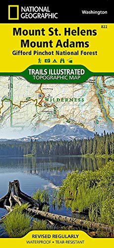
-
Letters From Rifka
National Geographic Learning National Geographic Learning
Paperback (National Geographic School Pub, Aug. 16, 2005)In 1919, Rifka and her family must leave Russia to go to America because they are Jewish, but when they arrive at Ellis Island, she is separated from her family. She finds strength through writing letters, but will she ever see her family again?
-
National Geographic Concise History of the World: An Illustrated Time Line
Neil Kagan
Hardcover (National Geographic, Oct. 24, 2006)From the dawn of humankind to today's global complexities, this monumental volume presents world history from an original perspective that provides fresh insights with every colorful spread. Few references are as invaluable, all-inclusive, and satisfying to browse. For readers of all ages, world history is easily accessible, depicted as never beforeso that events occurring simultaneously around the world can be viewed at-a-glance together. For example, Texas Instruments launched the pocket calculator the same year the Soviet Union launched the first manned space station, in 1971. Columbus sailed from Spain the year Martin Behaim constructed a terrestrial globe in Nuremberg. The California Gold Rush followed the Irish Potato Famine in the 1840s, and the Greek dictatorship of Papadopoulos is overthrown the same year Emperor Haile Selassie of Ethiopia is deposed and U.S. president Nixon resigns, in 1974. The book's innovative time line truly sets it apart, allowing readers to scan across a spread and explore a single area or compare contemporary societies across the globe. This remarkable resource also contains dozens of maps; scores of sidebars; hundreds of illustrations; and thousands of events, milestones, personalities, ideas, and inventions. Throughout, vivid illustrations depict artworks, artifacts, portraits and dramatic scenes, while sidebar topics range from local customs and lifestyles to the effect of climate change on human migration. Drawing on National Geographic's vast resources, this concise yet comprehensive, one-of-a-kind work is as rewarding as it is compulsively readable.