-
Atlas of Adventures Activity Fun Pack: with a coloring-in book, huge world map wall poster, and 50 stickers
Lucy Letherland
Paperback (Wide Eyed Editions, March 3, 2016)Get busy with this activity book packed with stickers, maps, global wildlife, cultural activities, and exciting adventures from around the world. Color in every continent and put together your own adventure as you decide whether you'd prefer to stay in a treehouse, an igloo, or a lighthouse, and whether you'd rather travel by camel, tuk tuk, or hot air balloon. Pull out the huge double-sided poster to see the country flags of the world, or flip it to find a world map, ready for you to customize over 50 stickers. P
P
-
Atlas of the World
Oxford University Press
Hardcover (Oxford University Press, Oct. 1, 2016)The only world atlas updated annually, guaranteeing that users will find the most current geographic information, Oxford's Atlas of the World is the most authoritative atlas on the market. Full of crisp, clear cartography of urban areas and virtually uninhabited landscapes around the globe, the Atlas is filled with maps of cities and regions at carefully selected scales that give a striking view of the Earth's surface. It opens with a fascinating look at world statistics and 18 pages of stunning satellite images, all sourced from NASA's latest Earth Observation Satellite, Landsat 8. The extraordinarily extensive front matter continues with a "Gazetteer of Nations" that has been comprehensively checked and updated to include recent economic and political changes, and a 48-page "Introduction to World Geography," beautifully illustrated with tables and graphs on numerous topics of geographic significance, such as the geology and atmosphere of Earth, food and water supply, biodiversity, energy, global conflict, human health, and standards of living. The hundreds of city and world maps that form the body of the Atlas have been thoroughly updated for this 23rd edition.Providing the finest global coverage available, the Atlas of the World is not only the best-selling volume of its size and price, but also the benchmark by which all other atlases are measured.
-
Atlas of Miniature Adventures: A pocket-sized collection of small-scale wonders
Emily Hawkins, Lucy Letherland
Hardcover (Wide Eyed Editions, March 3, 2017)Discover the world's smallest adventures with this beautifully illustrated journey around the world from the award-winning team behind Atlas of Adventures.Explore seven continent maps and learn about the best small-scale adventures on Earth - whether you're taking a ride on the world's largest miniature railway, sending a letter with the wolrd's smallest post office or cruising coral reefs with the smallest seahorse, this book brings together coolest miniature adventures from the four corners of the globe.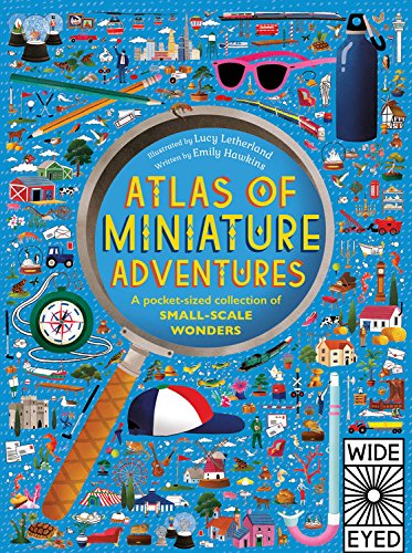 V
V
-
Atlas of the World
Oxford University Press
Hardcover (Oxford University Press, Oct. 1, 2009)The only world atlas updated annually, guaranteeing that users will find the most current geographic information, Oxford's Atlas of the World is the most authoritative resource on the market. The Sixteenth Edition remains the finest international reference source of its kind available. Including new census information, dozens of city maps, gorgeous satellite images of Earth, and a geographical glossary, this atlas offers exceptional value at a reasonable price. Full of crisp, clear cartography of urban areas and virtually uninhabited landscapes around the globe, the Atlas has maps of 69 cities and nearly 100 different regions at carefully selected scales that give a striking view of the Earth's surface. Opening with world statistics and a colorful, instructive 48-page Introduction to World Geography--beautifully illustrated with tables and graphs--this acclaimed resource provides details on such topics as climate, the greenhouse effect, plate tectonics, agriculture, population and migration, and global conflicts. As in years past, this edition includes the latest geographic information. The popular satellite image section has been refreshed with stunning new images of different regions and urban areas. A completely updated Gazetteer of Nations provides an invaluable A-Z reference of concise country profiles, including statistics on economies, politics, and historical profiles. Providing the finest global coverage available, the Atlas of the World is not only the best-selling volume of its size and price, but also the benchmark by which all other atlases are measured. · Interior pages designed for heightened accuracy and ease of use · Detailed city plans and country profiles make it the ultimate geographic reference The Design Oxford's Atlas of the World is a sturdy, high-quality, large-format book that is filled with crisp cartography, spectacular satellite imagery, and a wealth of information on changing conditions around the planet. The Special Sections Oxford's Atlas of the World provides an extensive intro to World Geography, up-to-date information on current events of geographical significance, captioned satellite images of the Earth, facts and figures on every sovereign state, and detailed coverage of 69 major urban areas. The Quality of Information Oxford's Atlas of the World is the only world atlas that is updated annually, guaranteeing that users will find the most current geographic information. It is the most authoritative resource on the market and offers the most current global information available today through a combination of statistics, maps, and photographs. The History Oxford University Press is known around the world for excellence, tradition, and innovation. The Atlas of the World is the best-selling volume of its size and price and the esteemed benchmark by which all other atlases are measured. The Price You receive a lavish, top-quality product at an excellent price that is comparable or lower than the main competitors.
-
A World of Discovery
Richard Platt, James Brown
Hardcover (Candlewick Studio, Sept. 18, 2019)An essential compendium of some of the most world-changing discoveries and inventions of all time, from the first use of money to antibiotics and artificial intelligence.In a stylish miscellany, celebrated author Richard Platt and printmaker James Brown travel through time to showcase the amazing breakthroughs in science and technology that have changed our lives forever. From the wheel to the telephone to the Internet, human history is studded with innovations that have changed our world. Each bold, bright, and beautiful infographic is complete with engaging and easy-to-understand explanations. A follow-up to international bestseller A World of Information and its companion, A World of Cities, this book covers thirty groundbreaking discoveries and is perfect for inquiring minds of all ages. V
V
-
Atlas of the World
Oxford
Hardcover (Oxford University Press, Oct. 15, 2008)Oxford's Atlas of the World is the most authoritative resource on the market. The Fifteenth Edition remains the finest international reference source of its kind available. Including a free world wall map in every volume, updated census information, dozens of city maps, a gazetteer of nations, gorgeous satellite images of Earth, and a geographical glossary, this atlas offers exceptional value at a reasonable price. Full of crisp, clear cartography of urban areas and virtually uninhabited landscapes around the globe, the Atlas has maps of 69 cities and nearly 100 different regions at carefully selected scales to give a striking view of the Earth's surface. Opening with world statistics and then a colorful, instructive 48-page Introduction to World Geography--beautifully illustrated with tables and graphs--this acclaimed resource provides details on such topics as climate, the greenhouse effect, plate tectonics, agriculture, population and migration, and global conflicts. As in years past, this edition includes the latest geographic information: a new flag for Iraq, the addition of the Republic of Kosovo to the map of Europe, a new region in Senegal and two provinces in the Philippines, plus the appearance of the world's newest landmass, Warming Island, revealed by the melting Greenland ice sheet. Current census statistics also help to illustrate tables showing the population of world countries and cities and the popular satellite image section has been refreshed with stunning new images of different regions and urban areas. Providing the finest global coverage available, the Atlas of the World is not only the best-selling volume of its size and price, but also the benchmark by which all other atlases are measured. *Promotional world wall map included with every copy *Interior pages designed for heightened accuracy and ease of use *Detailed city plans and country profiles make it the ultimate geographic reference "An indispensable reference." --The Today Show "A veritable encyclopedia of geographic and demographic information, profusely illustrated. Extraordinary." --The New York Times "This authoritative volume is the standard by which others will be measured." --Boston Herald "You can't do better than the Atlas of the World." --Chicago Tribune
-
A World of Cities
James Brown
Hardcover (Candlewick Studio, Oct. 16, 2018)From the lights of Paris to the cherry blossoms of Tokyo, the world is yours to explore in this comprehensive tour of thirty dazzling cities across the globe.Visit places you have only dreamed of in an elegant celebration of cities around the world. From Shanghai, Berlin, and Cairo to Seoul, Delhi, and Rome, explore each locale by way of bold illustrations and unlock a miscellany of intriguing facts. Did you know that Prague has the world’s oldest still-working astronomical clock? Or that there are more museums in Mexico City than anywhere else in the world? In a follow-up to international bestseller A World of Information, printmaker James Brown has skillfully rendered each city in a stylistic nod to vintage travel posters, while incorporating historical and cultural facts for inquisitive minds to devour. Wander the distinctive cities of the world, all from the comfort of your favorite reading nook. R
R
-
Atlas of Record-Breaking Adventures: A collection of the BIGGEST, FASTEST, LONGEST, TOUGHEST, TALLEST and MOST DEADLY things from around the world
Emily Hawkins, Lucy Letherland
Hardcover (Wide Eyed Editions, Oct. 6, 2020)Atlas of Record-Breaking Adventures brings together some of the world's most spectacular sights and extraordinary events in a stunningly illustrated addition to the critically acclaimed Atlas of Adventures series. Journey from one extreme to the other as you turn the page to discover what record-breaker is next. This is a high-octane tour around the world, stopping off at every continent to marvel at natural and human phenomena. From the highest waterfall to the deepest underground city, the largest primate to the smelliest flower, this is an adventure that can’t be beaten. Whether you’re exploring the hottest place on Earth in Ethiopia, the world’s largest cave in Vietnam, or riding the longest railway across Russia, adventure is all around you in this fun-packed atlas.Richly detailed illustrations by Lucy Letherland bring every adventure to life—as well as some quirky characters hiding among all the excitement.Emily Hawkins’ expertise provides all you need to know to plan your next adventure—or whisk you there from the comfort of your sofa!With over 30 scenes to explore, adventurers 7 years and older will find hundreds of things to spot, with facts about our astonishing planet to learn on every page. Get ready to meet some incredible record-breakers in this beautifully illustrated compendium of wonders.Praise for the Atlas of Adventures series: ‘It encourages curiosity, understanding and tolerance and nurtures a love of the world around us.’ – The Bookbag, on Atlas of Adventures ‘Lucy Letherland’s inky illustrations make the book a joy to look at.’ – The Guardian, on Atlas of Dinosaur Adventures ‘… it is akin to opening up a chest of treasures.’ – BooksforTopics, on Atlas of Adventures: Wonders of the World ‘Another absolutely gorgeous addition to the Atlas of Adventures series.’ – Goodreads, on Atlas of Ocean Adventures
-
The Medieval Knight
Christopher Gravett
Hardcover (Brighter Child, Feb. 9, 2001)Step inside the world of the medieval knight…into his castle as he prepares for a feast in the Great Hall, as he enters into battle and as he mounts his hors3e preparing for the joust.In The World of the Medieval Knight stunning cutaway views, brilliant panoramas and step-by-step sequences are all created by the illustrator Brett Breckon. His unique “exploded views” reveal in lavish detail the intricate way the knight’s armor was built.Discover how a page learned how to become a knight, how a knight’s horse was armed, how a castle was attacked and defended, how heavy the knight’s armor really was and what happened to the role of the knight. W
W
-
Merriam-Webster's Student Atlas
Inc. Merriam-Webster
Paperback (Merriam-Webster, April 16, 2006)New Title! A colorful, engaging world atlas ideal for home or classroom especially designed for students in grades 5-9. Packed with full-color maps, photographs, and easy-to-use charts and graphs. Includes thematic maps of continental drift, the ocean floor, the environment and natural resources, as well as a special Map Skills section introducing key geography concepts.
-
Atlas of the World
(by title)
Hardcover (Oxford University Press, USA, Nov. 20, 2003)Ten years ago, the first edition of Oxford's Atlas of the World was met with praise for the incredible beauty and accuracy of its maps as well as for its wealth of geographic data, and it only collects more accolades with each edition. The New York Times Book Review called it a "veritable encyclopedia of geographic and demographic information, profusely illustrated with multicolored maps and graphs," and Library Journal exclaimed that the newest edition was "a splendid achievement in geographical reference." The additions and improvements continue with an 11th Edition that boasts several new features. A Glossary of Geographical Terms will be an enormous asset to those unfamiliar with geographical jargon, and still more of the latest statistics will be collected in the colorful Introduction to World Geography section-providing abundant information on global issues such as climate, the greenhouse effect, plate tectonics, agriculture, population and migration, and global conflicts. Reflecting our turbulent and ever-changing planet, the 11th Edition will also highlight several key Regions in the News, keeping the atlas in step with current events. National Parks and Game Reserves have been added worldwide, and the overall precision and clarity of the entire book has been enhanced with redesigned map spreads. Laden with outstanding cartography, a revised Gazetteer of Countries, and nearly 70 sharp maps of the major cities on each continent, the Atlas also bears the distinction of being the only one of its kind that is updated annually to reflect the changing world around us. The recent dissolution of Yugoslavia, changes to provinces in Indonesia, refined name forms in Africa, alterations to administrative areas in Russia and Ethiopia, and dozens of other upgrades make this the most reliable atlas on the market. Providing the finest global coverage available, the Atlas of the World sets the standard for international atlases, living up to its reputation as an "indispensable reference," granted by NBC's Weekend Today Show.
-
Toulouse-Lautrec
Bernard Denvir
Paperback (Thames & Hudson, July 15, 1991)This account of Toulouse-Lautrec strips away the mythology to look afresh at his achievements both as a graphic artist and a painter. It revitalizes and adds depth to the well-known images, while a wealth of contemporary material (correspondence, reviews, anecdotes and reminiscences) sheds new light on the challenges that faced the artist. Bernard Denvir examines all the major influences on his life and work: the eccentricities and instabilities of his aristocratic background; the indignities of his handicaps; his education and artistic training; the theatres, bars, cafes and brothels to which he increasingly gravitated; and the political and social unease of late nineteenth-century France. 170 illus., 31 in color.