-
Rand McNally Atlas of World Geography
Rand McNally
Paperback (Rand McNally, May 31, 2017)Rand McNally's Atlas of World Geography provides engaging and richly illustrated geographic information for secondary students from grades 6-12. Thematic maps, graphs and charts help present a more complete portrait of our physical and political world. Atlas of World Geography features: 85 pages of detailed physical and political maps Engaging illustrations, photography, and infographics 35 pages of human and physical world geography maps, graphs, charts, including information on plate tectonics, climate, environments , population and economics Updated Countries section including flag, capital city, area and population Glossary of foreign terminology plus comprehensive index to enrich and maximize use of maps Special continent sections exploring landforms, land cover and use, climate, and continent specific issues and current events
-
Map It! Seek & Find Atlas of Brainy Challenges
Rand McNally
Perfect Paperback (Rand McNally, July 21, 2017)This is no ordinary puzzle book. Rand McNally's new Map It! Seek & Find Atlas of Brainy Challenges features iconic maps with layers of detail, colorful artistry and scientific precision with an invitation to explore, if you're up for the challenge! Journey from state to state and re-discover places you've been and open your eyes to some you never knew existed. Get lost in our beautiful cartography while seeking and finding your next adventure. Features:24 state maps in full detail on every pageMap legend helps identify hard to find placesAnswers key index on back pages8-3/8 x 10-5/8
-
Atlas of American History
Rand McNally
Paperback (Rand McNally, Aug. 16, 2015)Rand McNally's Atlas of American History is a great intermediate history atlas geared for 5th-12th grade students and beyond. Our colorful, engaging maps illustrate key events in U.S. history such as Westward Expansion in the early 1800s and much more. Atlas features: Organized by important periods of American history More than 80 colorful maps illustrating key events and eras, from routes of the first Americans through life in the United States today Chronologies, graphs, charts, and photos for each of eight historical periods Tables of facts about states Geared for students in 5th-12th grades 80 pages (including detailed index), paperback, 8" x 10"
-
Atlas of World Geography
Rand McNally
Paperback (Rand McNally, June 30, 2009)Rand McNally Paperback Atlas of World Geography features more than 65 highly detailed physical and political maps, along with thematic maps that show plate tectonics, population, land use, climate and more. This atlas has 20 pages of graphs, charts and tables that provides comparative information about physical, political, economic and cultural features of the world and special continent sections the highlight such themes as deforestation in South America. Created for grades 6 to 12. Measures 11 x 8-1/2 inches. Includes: 1 Atlas Book
-
Rand McNally Easy To Fold: Colorado
Rand McNally
Map (Rand McNally, Oct. 8, 2018)Description The durable and convenient Colorado EasyToFold state map will take all the wear and tear your journey can dish out. The heavy-duty laminated design allows you to mark your route, make notes, then wipe the surface clean for further use. This is a must-have for navigation whether you're a state resident or just passing through. Easy to fold means no fumbling Heavy-duty lamination allows you to write on, wipe off Durable and tear resistant Folds to display individual map sections Full-color maps with enhanced cartography Clearly indicated highways, county boundaries, points of interest, and more Quick-reference legend and city index Available for all 50 States Product Details Dimensions: 9" x 4.25" folded; 18" x 17" unfolded.
-
Rand McNally Philadelphia, Pennsylvania Street Map
Rand McNally and Company
Paperback (Rand Mcnally, Oct. 31, 2013)None
-
Picture atlas of the world
Rand McNally
Hardcover (Rand McNally, Aug. 16, 1991)Maps of the different regions of the world show their geographic, cultural, and economic features. Includes text describing the individual countries.
-
Rand McNally Folded Map: Atlanta Street Map
Rand McNally
Map (Rand McNally, March 15, 2017)Rand McNally's folded map for Atlanta is a must-have for anyone traveling in and around this part of Georgia, offering unbeatable accuracy and reliability at a great price. Our trusted cartography shows all Interstate, U.S., state, and county highways, along with clearly indicated parks, points of interest, airports, county boundaries, and streets. The easy-to-use legend and detailed index make for quick and easy location of destinations. You'll see why Rand McNally folded maps have been the trusted standard for years. Regularly updated Full-color maps Clearly labeled Interstate, U.S., state, and county highways Indications of parks, points of interest, airports, county boundaries, schools, shopping malls, downtown & vicinity maps Easy-to-use legend Detailed & full street index Convenient folded size Coverage Area Communities Included: Avondale Estates, Chamblee, Decatur, Doraville, East Point, Forest Park, Hapeville, Marietta, Morrow, Smyrna, Stockbridge, Union City plus downtown enlargement Product Details Measures 9.5" x 4" and folds out to 40" x 28".
-
Coast-to-Coast Games
Rand McNally
Perfect Paperback (Rand McNally, May 1, 2015)This book features cities, national parks, and popular attractions in six main regions of the United States. Each city or place includes a brief description and a different activity. Answers for all games and puzzles are in the back of the book with an index. R
R
-
Easy To Fold: Texas
Rand McNally
Map (Rand McNally, Nov. 1, 2012)The durable and convenient Texas EasyToFold state map will take all the wear and tear your journey can dish out. The heavy-duty laminated design allows you to mark your route, make notes, then wipe the surface clean for further use. This is a must-have for navigation whether you're a state resident or just passing through. Easy to fold means no fumbling Heavy-duty lamination allows you to write on, wipe off Durable and tear resistant Folds to display individual map sections Full-color maps with enhanced cartography Clearly indicated highways, county boundaries, points of interest, and more Quick-reference legend and city index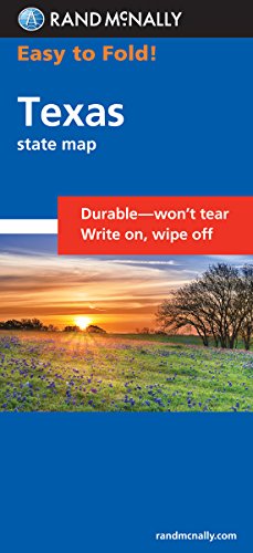
-
Jr Classroom Atlas
Rand McNally
Paperback (Rand McNally, Oct. 8, 2015)Trust Rand McNally's Junior Classroom Atlas for the right amount and level of information for your elementary students. Our colorful, engaging atlas is ideal for students in second through fourth grades and was developed from our award-winning Classroom Atlas, just simplified for younger students. Atlas features: •Completely redesigned with a new layout, eye-catching pictures, informative graphics, and fully updated map content •Teaches map and globe skills to younger students •Features photos, graphs, interesting facts, and thought-provoking questions that reinforce map concepts •Includes 15 physical, political, and thematic maps •Includes Handbook of Map Skills that helps students understand how to use maps and globes •Contains glossary that defines terms in the atlas •Elementary atlas geared for students from 2nd-4th grades •48 pages, paperback, 8.5" x 10 7/8"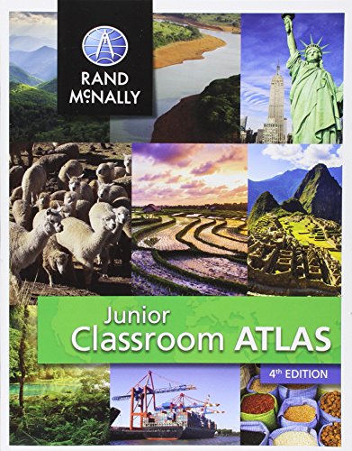
-
Album Of Dinosaurs
None
Hardcover (Rand McNally & Co, March 15, 1981)None